
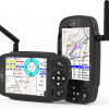
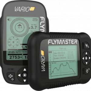
Main Hardware Characteristics
| Display Resolution (High Contrast Grey Scale) | 320×240 pixels |
| Screen size (true viewing area) | 76×57 mm |
| Battery Capacity (Lithium-Ion) | 2900 mAh |
| Autonomy Learn more | Approx. 27 hours |
| Size | 152x90x16 mm (Length x Width x Thickness) |
| Weight | 200 gr |
| GPS | 72 channel U-blox BeiDou, Galileo, GLONASS, GPS / QZSS |
| Native USB C Connection | Allows connection to the PC to download/upload Flight Data, Airspaces Data, etc |
| Battery Charging | From wall adapter, car adapter or standard usb port |
| Micro SD slot | Supports cards to 16 GB, Optional pre-loaded 16GB SD card with airspace, ground data and maps now available. |
| 6 Axis accelerometer and magnetometer | Allows 6-degrees of freedom Tilt-compensated Compass) |
| Firmware update by USB (upgrades are free) |
Interface Features
| User definable pages, 8 in portrait and 8 in landscape mode (each page can be draw using FIM software). | 16 |
| Configurable graphical elements (depending of the element several parameters can be set by the user ex. Size, Border, …) | 11 |
| Configurable data field elements (User can change size, border, title, Font, …) | 61 |
| Page Trigger Events (page switches automatically if a specific event occurs) |
|
| Multi lingual interface |
|
| Configurable audible alerts |
|
Variometer/Altimeter Features
- Buzzer/near thermal sound.
- Ultra sensitive Variometer with 10 readings per second and 10 cm resolution.
- Configurable vario digital filter and integration values.
- Fully configurable Vario Sound (frequency, increments, frequency/vertical speed relation,….).
- 6 Sound Levels (configurable by menu, or using a key).
- Automatic mute, keeps vario silent until takeoff.
- Altitude adjustment using QNH.
- Automatic altitude adjustment from GPS.
- 2 independent altimeters.
Memory Features
- 3D flight logger IGC format.
- Storage for >300000 track points.
- Up to 248 flights.
- 448 Waypoints.
3D Airspace
- Compatibility with Open Air format (upload of files using Designer).
- Display of restricted areas in map
- Adjustable warning vertical distance to a restriced area
- Adjustable warning horizontal distance to a restriced area
- Display of shortest Vertical, and Horizontal, distance to restricted area
- Resctrited area alarms (Altitude imminent, Position imminent, Violation, …)
- Critical Airspace page (displays information about areas that are closer than a defined distance)
- Worldwide Airspace database (SD card required) ( ).
Cross Country Features
- Exclusive Thermal Ball indicator
- Several specific data fileds like Distance to take off, current and avarage glide ratio, avarage speed, etc.
- Distance to last thermal indexed with altitude
- Goto waypoint
- Multiple waypoint route
- Wind Speed and Direction (GPS based calculations)
- Automatic altitude gain profiler
- Nearby Landings (Displays Required Glide Ratio and distance to all the Landings which can be reached)
Route Features
- Several Glides Ratios (average, to next,…)
- Easy route definition
- Route Navigation, configurable safety/risk margin on turn points.
- Route Map (trace with thermal indication)
Reviews
There are no reviews yet.